Instead of starting from emissive sources, the US agency has developed a pilot project that can detect greenhouse gases in the atmosphere via satellite and attribute them to individual countries. "Correcting" the declarations of the States
The system is complementary to traditional national inventories of greenhouse gas emissions
(sustainabilityenvironment.com) – So far we have always estimated the greenhouse gas emissions generated by individual countries from emissive sources. Each country must update its greenhouse gas inventory on an annual basis and submit it to the UNFCCC, the UN Intergovernmental Panel on Climate Change. With the possibility of partial or false declarations. Is it possible to obtain an estimate of greenhouse gases with a different approach?
National greenhouse gas emissions from space
This is what NASA scientists asked themselves in developing a pilot project that completely overturns the point of view. Instead of starting from the ‘bottom’, that is, from emissive sources, it uses satellite surveys of the greenhouse gases present in the atmosphere and attributes them to individual countries. The results are published on Earth System Science Data.
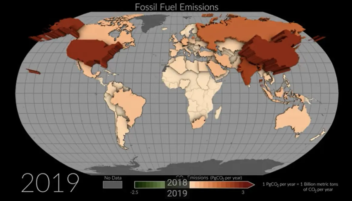
Thanks to the satellites of the mission Orbiting Carbon Observatory-2 (OCO-2), integrated by a network of ground detectors, NASA recorded changes in CO2 in the atmosphere between 2015 and 2020, on the basis of which it was then able to reconstruct the contribution of carbon dioxide emissions and removals. The map thus obtained covers 100 countries, just over half of the total.
“Our top-down estimates provide an independent estimate of these emissions and removals, so while they cannot replace the detailed understanding of traditional bottom-up methods, we can check the consistency of both approaches”, said Philippe Ciais, co-author of the study and director of research at the Laboratoire des Sciences du Climat et de l’Environnement in France.
Read also Absolute record of a decrease in greenhouse gas emissions in China, -230 MtCO2 from April to June
In addition to helping to verify the correctness of national inventories, The model developed by NASA is a useful tool to obtain better estimates of greenhouse gas emissions for those countries that do not have a capillary network of ground monitoring or resources to produce timely reporting. However, satellite surveys have proved to be very effective in monitoring emissive variations due to land use change, which is difficult to estimate in other ways.


